 |
Shiprock
is a census-designated place located in the northwest corner of New Mexico on a Navajo reservation. It lies within San Juan County in the Four Corners Region of the United States. As of the 2000 census, the population was 8,156 residents. The town is named after a nearby shiprock rock formation. This "shiprock" formation is one of the most impressive examples of a volcanic neck, or a central feeder pipe of a volcano. The remnant of an eruption around 30 million years ago during the Oligocene, it is the basalt core of an extinct volcano. Near the main peak, one can see small pinnacles, the remains of smaller auxiliary volcanic vents. The local Navajos consider the rock to be sacred, being a main character in their folklore. They call it Tse Bitai, meaning the winged rock. The community of Shiprock is home Dine College (formerly Navajo Community College,) which is a tribally controlled community college, with seven other campuses across the Navajo Nation. The town of Shiprock sits at a main junction for truck traffic and tourists visiting the Four Corners Region, Mesa Verde and the Grand Canyon. The town lies at the intersection of U.S. Highway 64 and U.S. Highway 491. However, despite its good location, the town does not have any hotels or motels - the nearest options would be in Farmington to the east and Cortez to the north. Shiprock is also home to the annual Northern Navajo Fair, held each October.

|
Shiprock Vacation Rentals
|

|
|
|
|
|
Shiprock Hotels and Resorts
|
|
|

|
Shiprock Weather & Climate
|

|
|
|
The northwestern corner of New Mexico offers a year-round pleasant climate. The area has four distinct seasons, although not as marked as other regions of the country. There is an average of 273 days of sunshine in northwestern New Mexico. Annual average rainfall is 7.5 inches and snowfall varies from 12.3 inches to as much as 100 inches in the higher elevations. Prevailing winds are mild, easterly and westerly. The northwestern corner of the state has a terrain of fertile river valleys surrounded by high desert, rolling plateaus, mesas and mountains to the north, east and west.
|
| Month |
High Temp |
Low Temp |
Rainfall |
Ocean Temp |
| January |
44°F |
19°F |
0.42 in. |
- |
| February |
50°F |
22°F |
0.38 in. |
- |
| March |
57°F |
25°F |
0.45 in. |
- |
| April |
65°F |
31°F |
0.43 in. |
- |
| May |
75°F |
41°F |
0.99 in. |
- |
| June |
85°F |
51°F |
1.32 in. |
- |
| July |
87°F |
55°F |
1.88 in. |
- |
| August |
84°F |
54°F |
2.76 in. |
- |
| September |
78°F |
48°F |
1.55 in. |
- |
| October |
68°F |
37°F |
1.20 in. |
- |
| November |
55°F |
26°F |
0.58 in. |
- |
| December |
45°F |
19°F |
0.60 in. |
- |

|
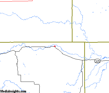
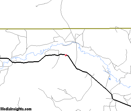
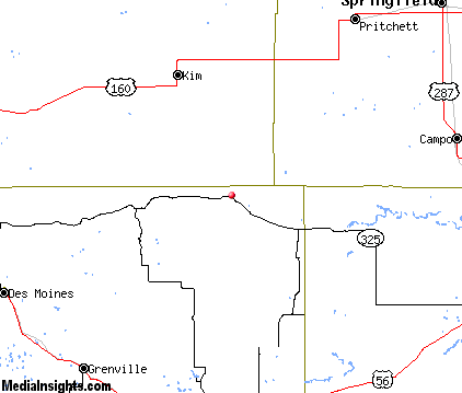
Shiprock Map & Transportation
|

|
|
 |
|
|
| Click each thumbnail image to enlarge. |
 |
|
 |
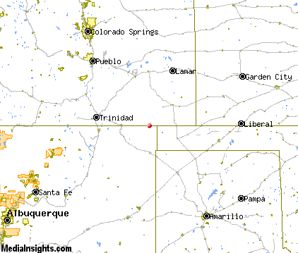 |
The closest airports in the area are the Springfield Municipal airport (8V7) located about 46 miles northeast of Shiprock in Springfield, Colorado, the Perry Stokes airport (TAD) located approximately 65 miles northeast of Shiprock in Trinidad, Colorado, Raton Municipal Crews Field (RTN) located roughly 73 miles west of Shiprock in Raton, New Mexico, and finally the Dalhart Municipal airport (DHT) located around 75 miles south of Shiprock in Dalhart, Texas.
|

|
Shiprock Attractions
|

|
|
| | | State Parks |
| Black Mesa State Park | | OK | 20.8 mi. | | | Clayton Lake State Park | | NM | 28.5 mi. | |
| | | Zoos and Aquariums |
| Pueblo Zoo | Pueblo | CO | 117.1 mi. | |
Notice a problem with the information on this page? Please notify us.
|
Disclaimer: We recommend you conduct your own research regarding all accomodations and attractions found on this website. The distances shown on this website are straight-line distances as the crow flies. The road distance may be considerably longer. You assume all liability for use of any information found on this website. No information is confirmed or warranted in any way. By using our services you agree to the terms and conditions of this disclaimer.
|
| We are the #1 site for your New Mexico Vacation presenting New Mexico vacation rentals, hotels, weather and map for each city. |
New Mexico Vacation .com
©1997-2025 All Rights Reserved.
|
|